The History File
JANUARY 2018
David Cummings
The crops grown on strip fields
-

Haymaking in Christleton
-

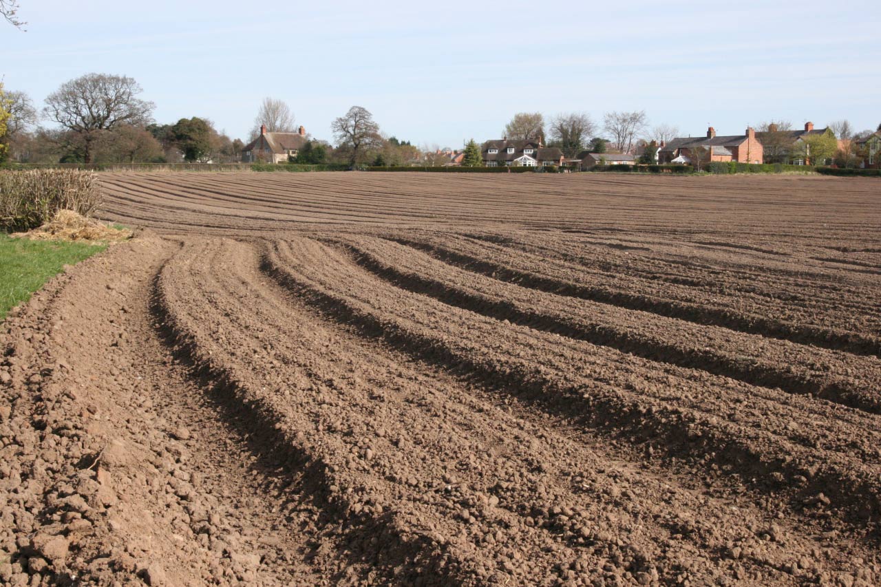
Ploughing
-

Ploughing
-

Ploughing
-

Pit Farm Christleton
-

Christleton Old Farm
-

Christleton Village Farm
-

Mosford;s Butcher Christleton
-

Old Farm Pepper Street Christleton
-

Joe Mosford - Butcher in Christleton


At first, a limited range of crops was grown on the strips, with grain, particularly wheat and oats, alternating with the field being left fallow for a year. Later many variations of crop rotations developed covering two, three of even four years. Each farmer might have strips in several fields and might also have the right to graze livestock on the stubble left behind after each harvest. The division of fields into strips and the regular ploughing of the same, each time turning the earth towards the centre of the strip, produced a regular undulating pattern across the field known nationally as ridge and furrow, but in Cheshire as butts and reans. These are still visible in some places in the parish, most obviously east of Rake and Stamford Lanes.
The butts and reans were usually ploughed by oxen in teams of four, and the wooden ploughs had a single board, or ploughshare. Horses gradually replace oxen from the 16th century onwards. The butt and rean system in both strip and ploughed fields had the practical advantage in clay areas, of preventing water from standing around and in times of flooding enabled plants to be on the drier ridge and also enable animals to stand on higher ground. This system can be seen operating today over many areas of New Zealand where despite inhospitable weather, sheep and cattle are kept out of doors for 365 days of the year. In this instance a great deal of rotation within fields takes place with animals being moved sometimes daily onto rested and un-grazed sections of the field. The fields are much bigger than we see in the UK, and the numbers of sheep and cattle far larger than we experience here.
During the last 50 years or so, many of the older ploughing patterns have been obliterated by the more intensive use of machinery and heavier cropping of both grassland and arable fields. There are no records of the conversion of most of the strips in Christleton into square or rectangular fields, but, by the mid 18th century, there may only have been four areas of strip field remaining. Townfield (Birch Heath Lane), Long Looms (Bricky Lane), Finneys or Finisfield (Plough Lane) and Cross Flat, which is now obliterated by house, the railway, the canal and the A55. Within the four fields there were 81parcels of land, or loons divided between 19owners. Robert & Gerard Townsend (The Old Hall) had 12, followed by Peter Hodson(Churchwarden) with 10, Sir Henry Harpur (Lord of the Manor) had 9. The area of each loon was measured in sowings, roods and yards. No one is certain what a sowing meant, but from the few fields left the following calculations can be made.
A Christleton yard of area is probably equal to eight or nine standard square yards.
Eight Christleton yards of area made a Christleton rood.
Twenty Christleton roods make a sowing.
Twenty Christleton roods were probably slightly larger than one standard rood, and a sowing was slightly larger than a standard quarter acre.
King Henry VIII had in theory, standardised systems of measuring areas, but even in the 19th century, Cheshire surveyors still used an acre that was twice the national standard area.
It was the duty of each landowner to provide hedges around his or her property after the layout of the land was agreed, hence enclosure. Some of the hedges were in straight lines, or followed the landscape, and despite the recent removal of hedges some of the original lines can still be seen. This is often evident where marl pits now seem stranded in open fields, but were once situated close to a hedge/field boundary or between two fields, initially supplying marl for improving the quality of the soil, and later as a source of water for grazing animals.
-

Sheep Farming in Christleton
-

Cottom Edmunds Farm Christleton
-

Marl Pit Christleton
-

Field for Market Garden Crops Christleton
-

Arden's Farm Christleton
-

Potato Field Christleton
-

Oilseed Rape Christleton
-

Ardens cutting Wheat in Christleton
-

Cut Wheat Fields Little Heath Christleton
-

Barley Crop Christleton


The 1844 tithe map still shows that there were areas of strip farming left in the parish but also that up to 400 marl pits were still in existence, I guess this is part of the reason that Cheshire was known as the pond capital of England and Christleton Parish had a good proportion of these. The ownership of farmland in Christleton in 1844 was following a pattern of change that had been gradually developing in most places for over 300years or more, with fewer owners, many of whom were involved in diverse professions or businesses elsewhere. Half of the farmland in Christleton in 1844 was in the hands of three owners; Townsend Ince (341 acres) John Brock Wood (312 acres) and trustees of the late Thomas Hodson (113 acres). The Rector also held 56 acres as his glebe land. Very little of the land was farmed by the owners, the land being split into smaller sections and tenanted by local people.
The tithe document shows that large areas of the parish were arable, meadow or pasture. Livestock rearing was the main priority but not to the total exclusion of planted crops. At this time a high proportion of village men were employed on the land, and the village was almost self contained in the production of food. Milk, butter, cheese could be obtained from several farms, and there were two slaughter houses in the village for the production of meat. Many were mixed farms, keeping hens, pigs, cattle, horses, sheep and goats, as well as growing salad crops, a practice that has now almost totally disappeared. For centuries Cheshire had the reputation of being a “dairy county”, but from the evidence available Christleton has always had a good proportion of arable crops being grown.
Oil Seed Rape
Over recent decades farming in Christleton has changed in many ways. Many hedges have been removed, most grassland has been improved by reseeding with fewer, more productive grass species, and most arable areas are worked very intensively. Newer crops such as oil seed rape and maize have been introduced, and the grazing animals now include sheep. The parish had a total of 25 farms after WWII, but the change since has been rapid, especially after the UK joined the European Community. Dairy farming once a great part of life in the Parish has almost disappeared, with White Lane Farm being the only dairy farm in the Christleton township. A handful of dairy farms are left in Rowton, and Cotton Abbotts farm with its herd of over 350 dairy cattle is the largest.
Market Gardening once a large and important aspect of Parish life, with growers such as the Bewley, Chesworth, Kirk, Arden and Randal families prominent, has also declined. However the big field between the A55, the Canal, Pearl Lane and the Ring Road is still occasionally used to grow salad crops on an “industrial scale” and there is an important Tree & Plant Nursery in Littleton. Potatoes and broad beans are also a popular crop in the Parish, but the beans are usually ploughed in as a fertiliser. Some fields in rotation are also given over to produce lawn turf for the many new housing developments in the Chester area. The main arable crops are now wheat, barley, oats and oil seed rape.