The History File
March 2019
David Cummings
Pack Horse Bridges at Hockenhull
I am reprinting this article I found recently in a faded newspaper from 1962 given to me some years ago, which explores the story of the Pack Horse Bridges at Hockenhull. This article was found whilst I was investigating a question I was asked a month or so ago. “Why are the bridges called Roman Bridges?” I have now found a possible answer to that question which I will write about in April. So please enjoy Frank Marriott’s account from the Daily Post. Also fascinating reading I the same newspaper is a letter on the Letters from Readers Page which talks about “The threat of the Common Market” I wonder what that is all about!!!!
By Pack Horse Road to Chester by Frank Marriott
Published in the Liverpool Daily Post Friday January 5th 1962
About three hundred years ago, at the time John Ogilby, cartographer to Charles II sent men to survey the roads of England for his famous Britannia Road Book, the busiest road out of London was with little doubt the road to Holyhead.
Until the day when Telford opened his now famous A5 across the wilds of Wales early last century, the main route to Anglesey’s distant port traversed the easier English shires as far as Chester before turning westwards. The road approached Cheshire from Stone and Woore and after Nantwich used the celebrated Watfield Pavement to travel towards Tarporley.
Watfield pavement now lies beneath the straight stretch of road alongside the canal, and although the ancient stones might have been removed, the name remains on all but the lost modern maps. Watfield pavement apparently was the paved section of a Roman road, constantly repaired and maintained until the 18th C
One interesting feature of Watfield pavement is that from the map the road appears to line up with the first mile of the A51 road after it leaves the Watling Street at Stamford Bridge four miles eastward of Chester. This road, subsequently curved so as to include Tarvin, is shown on same maps as Holme Street. This could well be one of the Roman routes between Chester & Nantwich. On the last miles to the salt town the old track kept to the eastward of the present highway, but has long since disappeared.
Route was Changed
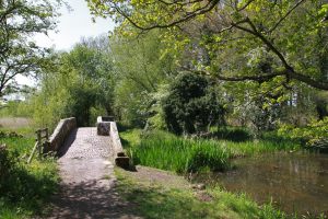
At some period in distant history the route from Nantwich to Chester was changed, as in the Middle Ages we find it turned westwards at Duddon Heath, some half a mile north of the Headless Woman Inn, and continued to Christleton, a village just off the Whitchurch Road, and only two miles from Chester. Although the main road has now resumed its old line to include Tarvin, the pre sixteenth Century way between Duddon and Christleton remains a four mile stretch of silent highway still holding in its grasp, the most treasured glimpse of medieval track in Cheshire, revealing three delightful pack- horse bridges connected by two cobbled causeways, built at least 400years ago to span the Gowy, and its low-lying adjacent fields.
When Ogilby’s man came on horseback from London in the 1660’s, with a lad walking beside him pushing a “way-wiser” to record distances, and notching off each mile as it passed, he recorded this stretch as being on the road from London to Holyhead.
The three stone bridges are shown quite clearly on the interesting strip map of Ogilby’s remarkable book. Even then the road was in danger of being superseded, for the map shows cartways already in existence, one to Chester by way of Stapleford, the Egg Bridge of today, and the other through “Tervyn” to the city.
First of the Bridges
From Duddon Heath the old road can be identified by extreme narrowness and its two rows of tall and ancient trees. Beyond the cluster of cottages at Hockenhull crossways the road is at first wide, but as one walks or cycles along the last bit of roughish trackway, (the car must be left some distance away), the path narrows, and the hedgerows come closer until they all but touch.
Then, at the end of the tunnel of trees the first of the three bridges comes into view, a wonderful pack horse span built in the narrow stiles of the old days, before carts came to clutter the roads and wide enough at five feet only to take but one weary packhorse, with his sagging panniers on either side.
Cobblestones surely as old as the span itself, a mere four centuries at the very least, stretch for a distance of some forty feet to surface the approaches to the bridge on either side, as well as the arch of this ancient river crossing. This first bridge is the only one of the three to maintain a constant width of five feet throughout its entire length; the others, although retaining the five foot dimension over the span, have wider approaches.
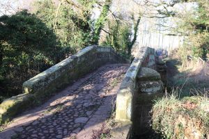
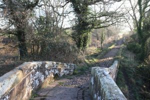
Only less interesting than the bridges are the causeways that lift this trackway of the ages above the storm waters of the Gowy River. Masonry walls, five feet high and five feet wide and in the first case seventy foot long, take the road to the middle bridge, the masterpiece of the three. It was not a matter of good fortune for the builder of the bridges that the path at this point has to make a distinct change of direction from roughly west to south west. In consequence of this we have a rare event indeed, of a pack horse span built on a curve, and for this reason is fairly reminiscent of the famous, three way relic at Crowland, on the edge of the Lincolnshire fens.
The second of the two causeways, some three times longer than the first, runs alongside the Gowy to the last of the bridges, a curious span with an overall length, including approaches of some forty nine feet.
Mystery of the Builders
Who built these bridges and when? And who maintained them in their early years? The published histories of the county are strangely silent on this remarkable fragment of an ancient road. The Roads and Bridges Department of the Cheshire County Council dates the bridges as probably early 16th Century, and it must be acknowledged that this authority maintains the bridges exceptionally well. The road is described in the records as Hockenhull Platts, a very old name for bridges in the locality. It so happens that this ancient track provides by one mile a shorter route between Tarporley and Chester than the main highway through Tarvin, and in view of this perhaps it is not surprising that proposals to convert the pack horse route into a wider road have been put forward.
Note: An article copied by David Cummings from an original faded newspaper (the Liverpool Daily Post January 1962) and donated to the Christleton Local History Group. The accompanying photographs are impossible to reproduce but show the first causeway extremely well.
-
Christleton side of the bridge
-
Tarvin side of the bridge
-
Tarvin side causeway
-
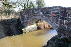
Hockenhull middle bridge from north side
-
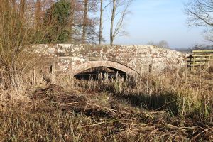
Christleton side bridge from the south
-
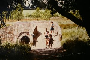
Historic shot of Hockenhull bridge
-
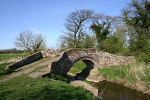
Hockenhull Bridge
-
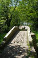
Hockenhull Platts
-
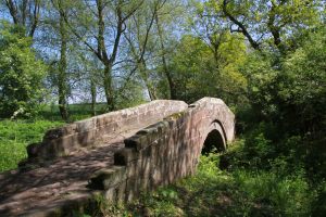
Tarvin side of the bridge from the south
-
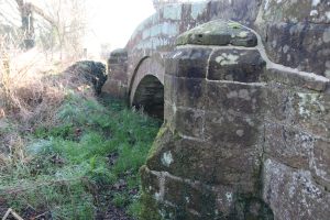
Buttress on Tarvin side of the bridge
-
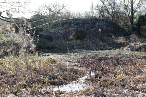
Christleton side of the bridge from the north
-
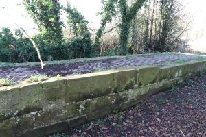
Raised causeway to the middle bridge
Addendum by Richard Nicholson
It is rarely I have the opportunity to add anything to David's carefully crafted history articles for the website but in this instance I cannot resist in including some additional information and material for my cartographic hero John Ogilby. I have been lucky to have owned over the years quite a number of copies of his amazing work 'Britannia', the first atlas to map the roads of England and Wales.
The Road from London to Holyhead by John Ogilby, 1675 displayed on fourplates
-
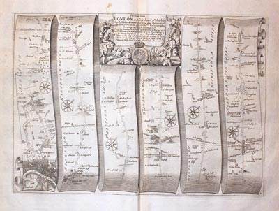
Plate 21 John Ogilby Road Map 1675
-
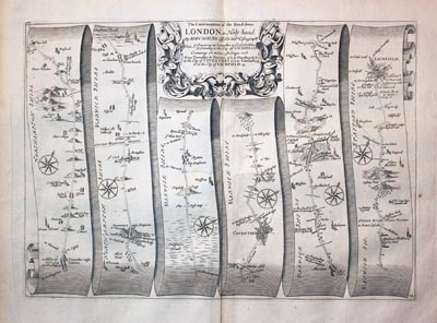
Plate 22 John Ogilby Road Map 1675
-
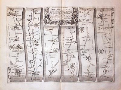
Plate 23 John Ogilby Road Map 1675
-
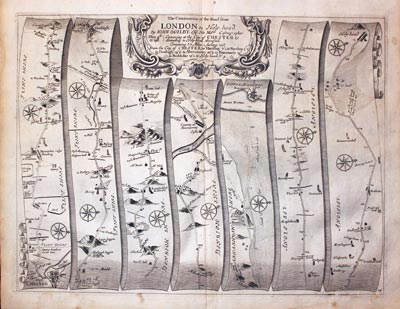
Plate 24 John Ogilby Road Map 1675
-
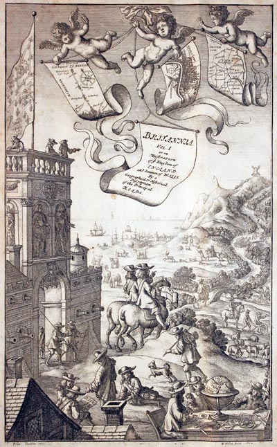
Frontispeice Brittania John Ogilby 1675
-
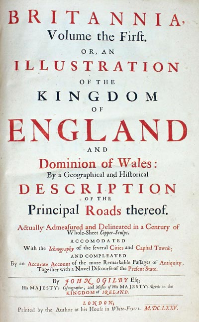
Titlepage Brittania John Ogilby 1675
-
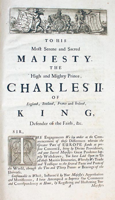
Dedication to Charles II
-
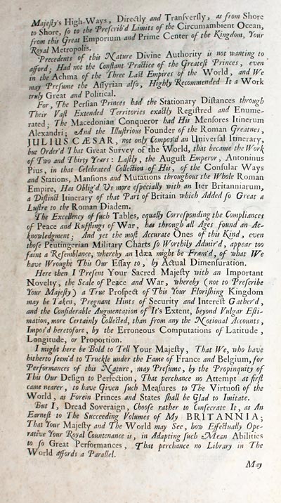
Ogilby Dedication to Charles II
-
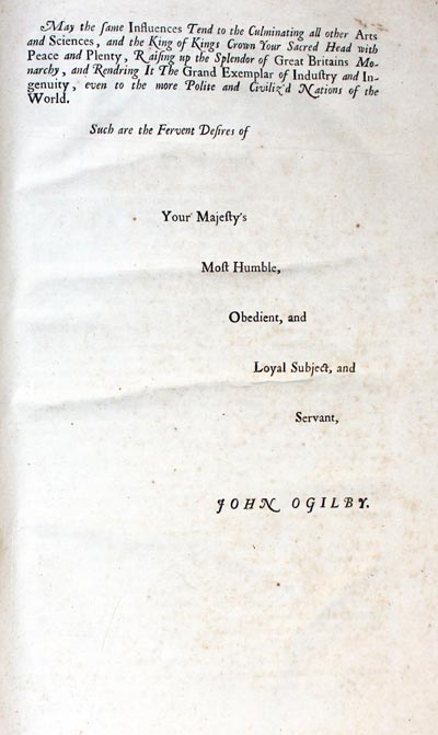
Your Majesy's Most Humble Servant John Ogilby
JOHN OGILBY
EARLY DAYS
John Ogilby was born in Kellemeune, ten miles north of Dundee in 1600. The publishing of Britannia, his road atlas of England and Wales in 1675 was a crowning success to an energetic, eventful and varied life. He came from a good family his education was not completed. His father, a member of the Merchant Taylors Company wasted his estate and was sent to prison for debt. John then aged about twelve supported his mother and himself by selling trinkets. John bought one or more lottery tickets at 2s.6d. each from the Virginia Company and he won one of the minor prizes and was able to pay his father's debts. Later John purchased an apprenticeship with a dancing master, John Draper of Gray's Inn Lane. He did well, having a natural talent for dancing and perhaps with the earnings from the illegal practice of apprentices giving lessons he was able to buy himself an early completion of his apprenticeship and set up a dancing school of his own. His continuing success and reputation brought important and influential pupils from far and wide.
###MISFORTUNE
At a masque arranged by the Duke of Buckingham to celebrate the Kings's gift to Buckingham of the estate at Burley-on-the-Hill, Rutland misfortune struck. During a dancing routine John made a false step, which caused him to fall to the ground and strain his leg. He was unable to dance again and was lame for the rest of his life. In his late twenties his many contacts made through his dancing career were to become most useful and he secured a position teaching the two sisters of Sir Ralph Hopton to dance at Hopton's house in Somerset. Sir Ralph taught John military science which stood him in good stead when he served in Ireland in a troop of guards in the 1630's under Viscount Wentworth, later Earl of Strafford and Lord Deputy of Ireland. To help establish a life style in Dublin similar to that being enjoyed in London it was decided that a theatre was required. This was the first theatre in Ireland situated in Werburgh Street. .It was the responsibility of John Ogilby to administer the theatre and persuade well known actors of the day to leave the comforts of London for the relative isolation of Dublin.
REVELS, RIOT AND RUIN
In about 1637 John was appointed Master of the Revels in Ireland and for the four years from 1637 to 1641 that the theatre was open it was a great success. The Irish Rebellion in October of 1641 caused the theatre to close. In 1642 John narrowly missed being blown up and in 1644 he left Ireland being shipwrecked on his homeward journey. He arrived back in England penniless and without a patron, Strafford having been executed. He spent the next four years in Cambridge and with the help his friend James Shirley he worked on the translations of the Bible and the classics of Virgil, Homer and Aesop. In 1648 he returned to London and on 14th March 1650 he married the widow Christian Hunsdon who had three children by her earlier marriage, Elizabeth, Thomas and Ellen, The eldest daughter Elizabeth was married to a Mr. Morgan.
RESTORATION
The Morgans had seven children, the eldest being a son named William The next few years for John Ogilby were spent in translating and the opening of a publishing business in London, where he produced a number of fine books. The Restoration of Charles II brought favour back to John Ogilby with a commission to help in the arrangements for the coronation in 1660 with the composing of speechs and songs. The increasing work load demanded an assistant and John was pleased to have the help of his promising wife's grandson William Morgan. A year later John was again made Master of the Revels in Ireland and he set about the building of a new theatre in Smock Alley, Dublin. By 1665 John Ogilby and William Morgan had returned to London to continue their work with books.
FIRE FORTUNE
Disaster struck in 1666 but Ogilby was not alone in losing his premises and entire stock as the Great Fire raged through London. John and William received a commission from the Lord Mayor and were appointed 'sworn viewers' or Surveyors of the preparation of a map of the City of London. The map was published ten years later by William Morgan on a scale of twenty five inches to the mile. It measured 9 x 7 feet and was dedicated to the Lord Mayor, Aldermen and Sheriffs of London. The preparation of the map brought John into contact with many influential persons of the day also concerned with the rebuilding of London such as the City Surveyor Robert Hooke, Sir Christopher Wren and John Evelyn. John Ogilby, now in his seventies, was to start the most original and ambitious achievement of his career. The mapping of the roads of England and Wales. As well as the awesome physical task of surveying the roads carried out by a number of assistants whose work was checked on its return to London John's time and expertise must have been directed towards the large financial cost of such a project.
ROYAL 'FAVOUR'
He turned to many people for money and support and received a number of promises one being for the sum of 1,000 pounds from King Charles and Queen Catherine of Braganza. The money, however never really changed hands as the import duty on the paper for the printing of the Britannia amounting to some 1,000 pounds was waived by royal consent and to be considered as a substitute for the contribution. Royal favour was bestowed in another way, however, in 1674 when John Ogilby received the title of 'His Majesty's Cosmographer and Geographick Printer' with a salary of £13.6s.8d per annum. In September of 1675 John Ogilby saw his dream fulfilled, the publication of the Britannia, dedicated 'To His Most Serene and Sacred Majesty The High and Mighty Prince, Charles Il of England, Scotland, France and Ireland, King, Defender of the Faith, &c.' with its magnificent frontispiece engraved by Wencelaus Hollar (1607 - 1677), a General map of England and Wales showing the roads and one hundred strip road maps each embellished with a decorative title cartouche with some bearing the royal arms, accompanied by a double sided page of text giving additional advice for use with the road map. There was no universal length in the British Isles at this time but Ogilby wisely chose the statute mile of 1,760 yards for his maps. The scale of the road maps is one inch to one mile and these are marked and numbered on each map, the miles further being divided into furlongs.
PREFACE
The Britannia proved to be most popular with the gentry and with travellers who were now able to plan their journeys with more certainty, knowing the distances between towns and what was involved. Some owners of the magnificent folio went as far as tearing out individual maps to carry with them on their travels through the kingdom. A second issue of the road maps soon appeared called Itinerarium Angliae illustrated with the 100 road maps to which were added useful plate numbers in the bottom right hand corner but without the indivual plate numbers of text for each map.
PRINTING PIRACY
The following year 1676 saw the publication of the latest edition of John Speed's Theatre of the Empire of Great Britain and John Ogilby was most distressed to see the pirating of his work by the publishers Thomas Bassett and Richard Chiswell who added tables of towns and distances to the Theatre. John Ogilby was not to see the further developments of his survey, however, for on 4th September, 1676 he died and was buried at St. Brides, one of Sir Christopher Wren's new churches. Mrs. Christian Ogilby died the following year. William Morgan who succeeded to the titles of Cosmographer Royal and Master of the Revels in Ireland carrying on Ogilby's work and in 1682 his magnificent large scale plan of London, Westminster and Southwark was published. William Morgan died in about 1690 and in 1698 the final edition of the Briltannia was published without the decorative Hollar frontispiece and without the individual pages of text.


