THE HISTORY FILE
FEBRUARY 2021
FLOODING

BY DAVID CUMMINGS BEM
Over the last two years Christleton Parish has seen the greatest amount of annual rainfall in living memory. In 2019 I recorded 52 inches (1300mm) and in 2020, 48 inches+ (1200mm) of rainfall. The average rainfall in the 1970's was 17½ inches (540mm) To date 9½ inches (240mm) has fallen in January 2021 and the level of water around the Pit has been exceptional. This amount of rainfall has caused great concern to farmers and residents, and everywhere pools have overflowed, ditches filled, paths have become muddy tracks and roads have been sometimes impassable. There are lots of records of the village being flooded in the early 1900’s when a village pond at the bottom of Village Road and Quarry lane overflowed, sometimes so badly that children from the Girls and Infants School couldn’t get across the road to get to their homes. The amount of water that fell in the village was compounded by the agricultural sewage that flowed down Village Road from nearby farms. Even the present “toast rack- car park” was formerly a pond for Digger Swindley’s Old Farm. A sewage and waste water system was laid in the village around 1910, but it is believed that the new pipes going through the village weren’t large enough to take any excess flood water under the canal and then into Caldy Brook, beyond the bend of the A41 opposite the "Cheshire Cat".
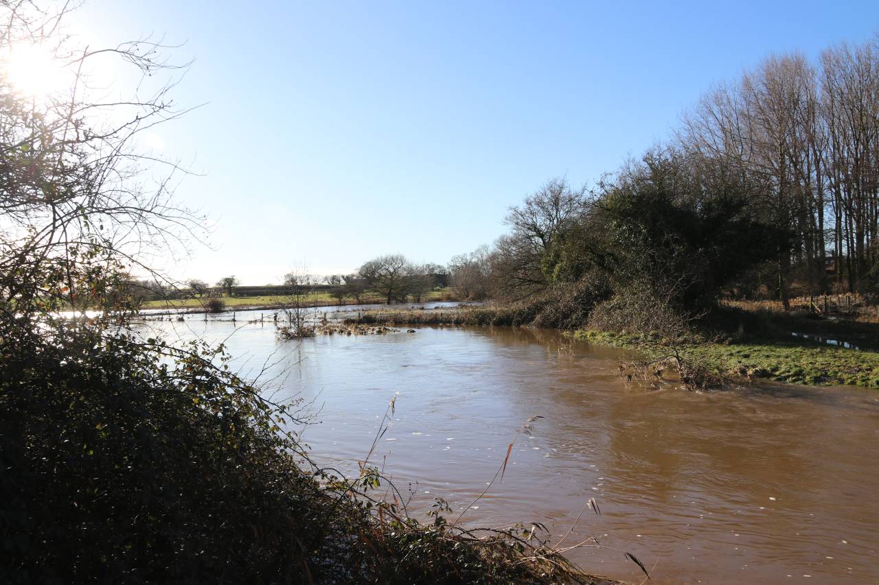
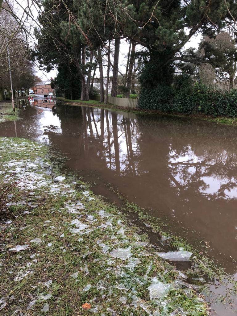
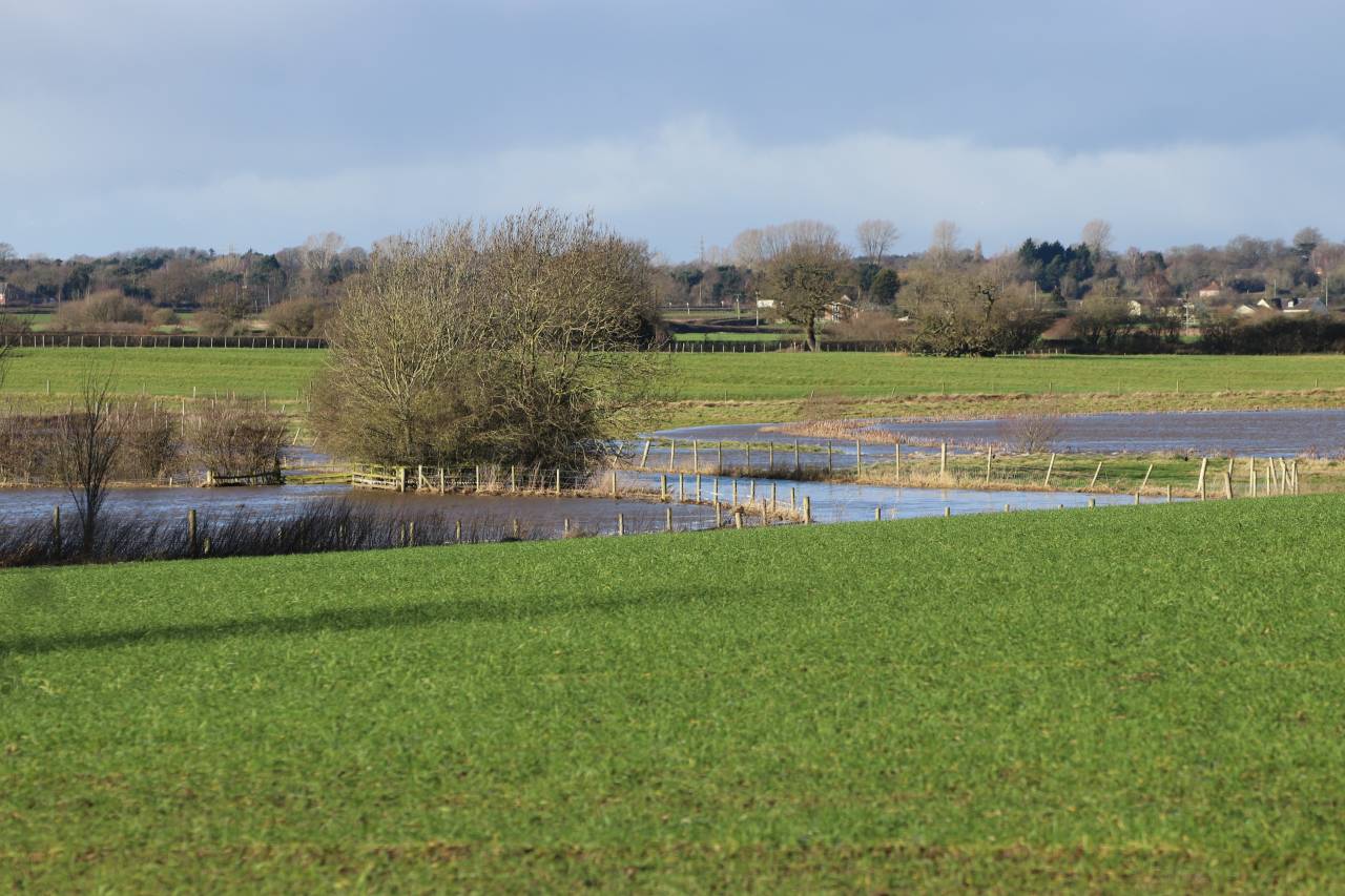
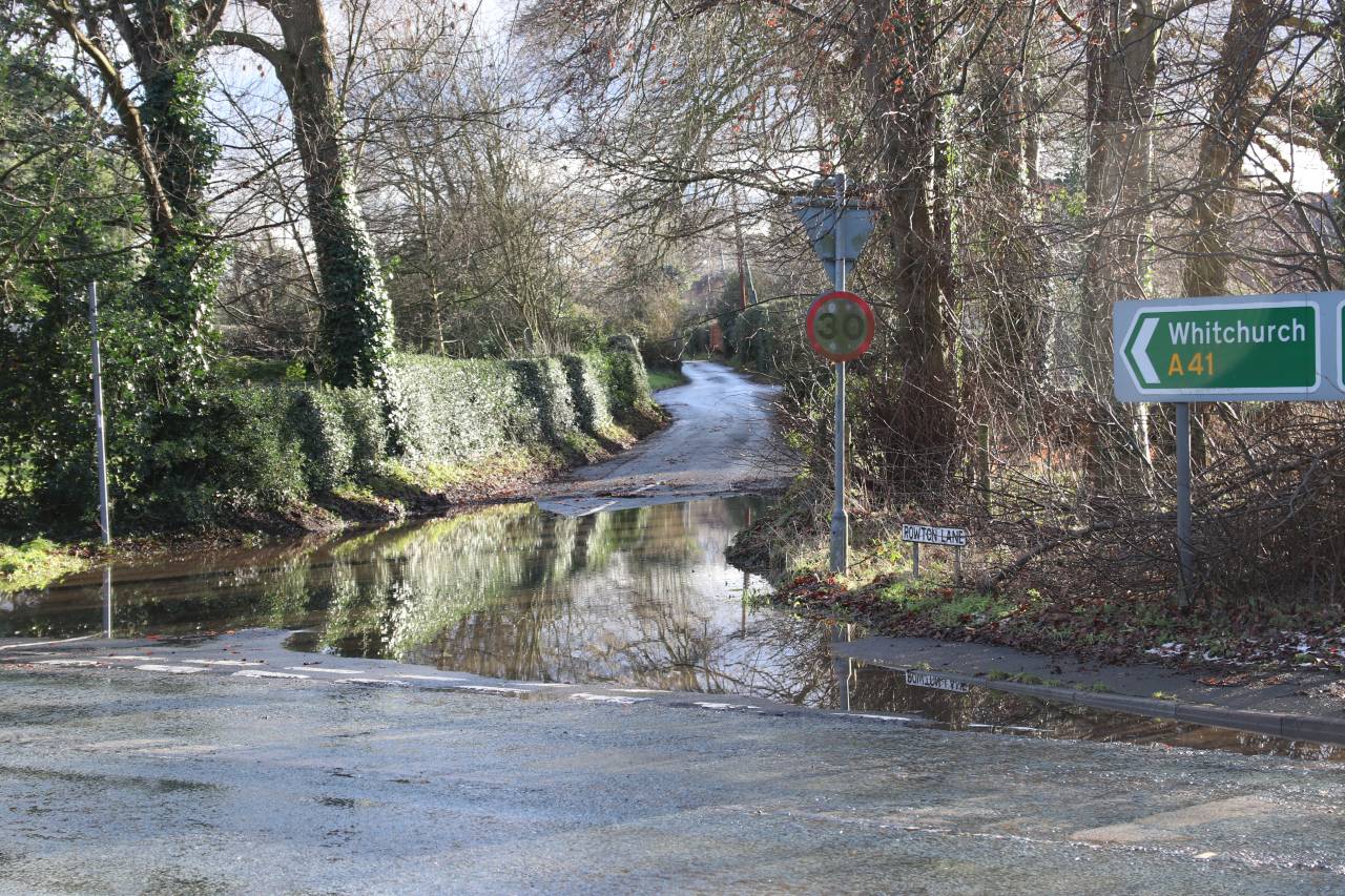
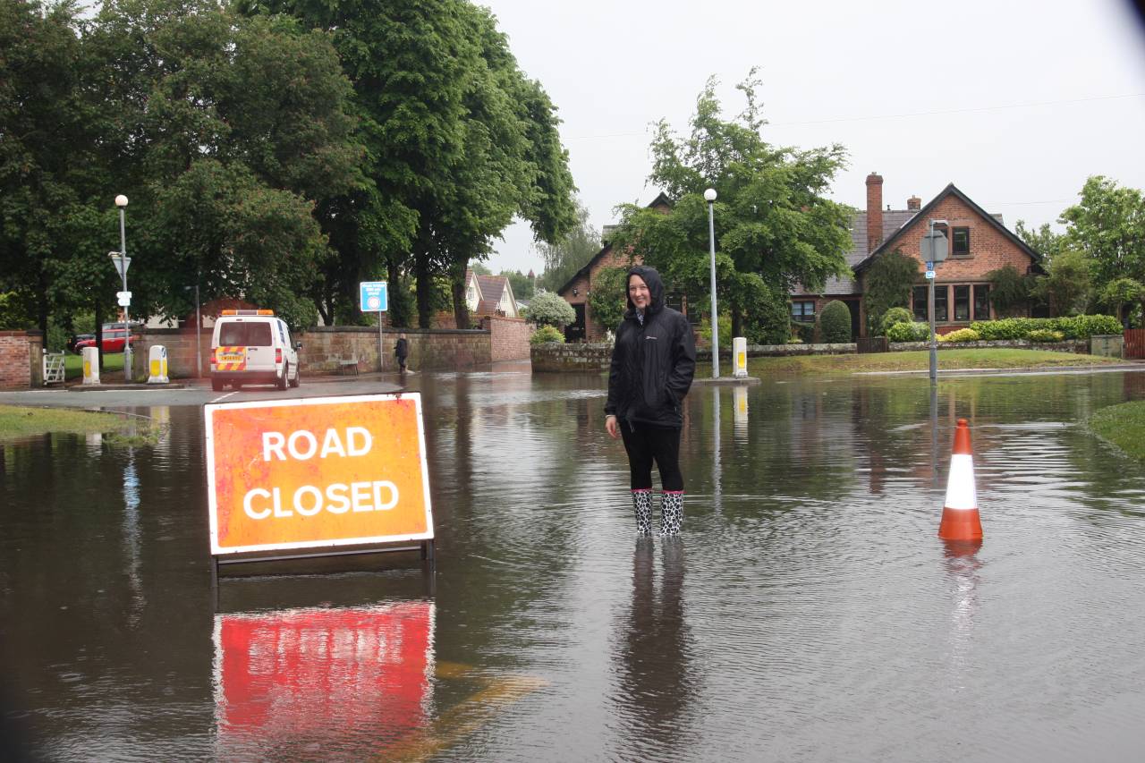
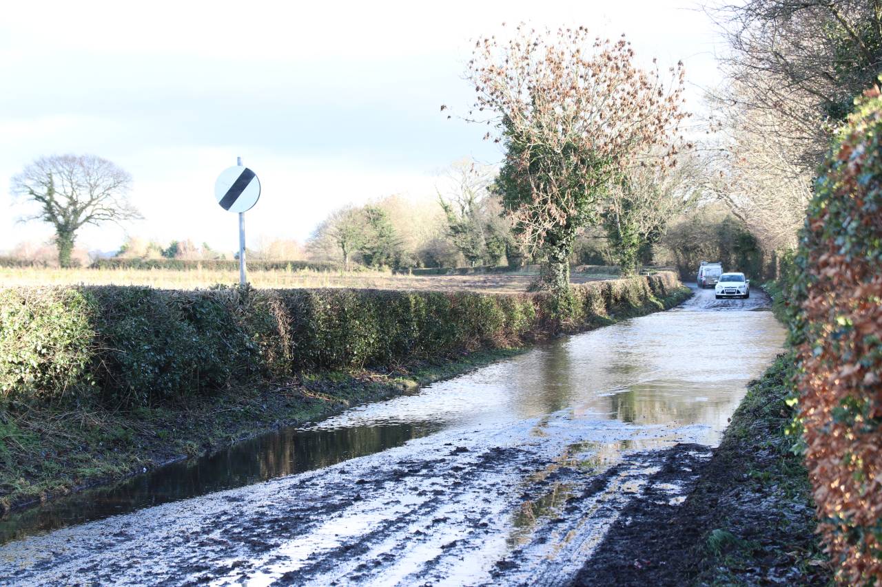
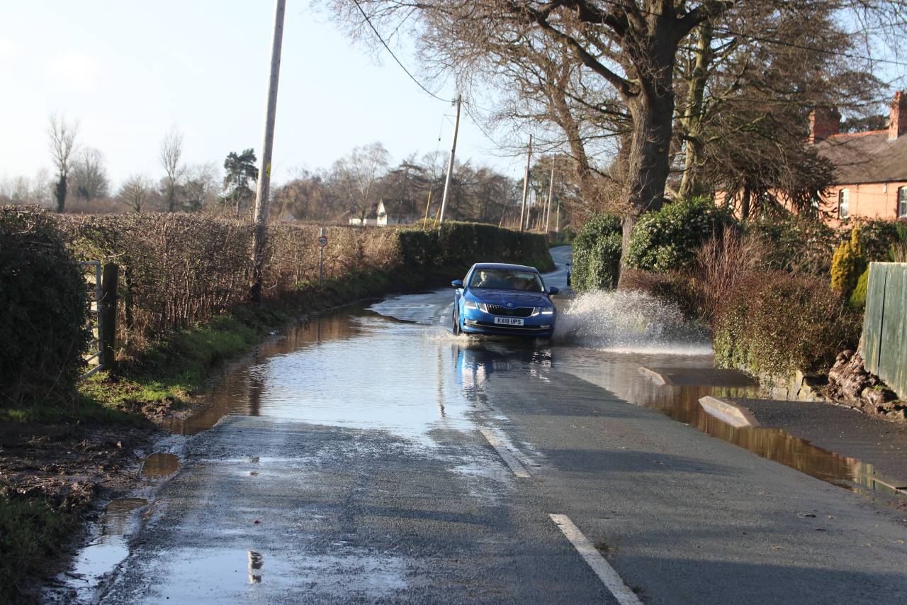
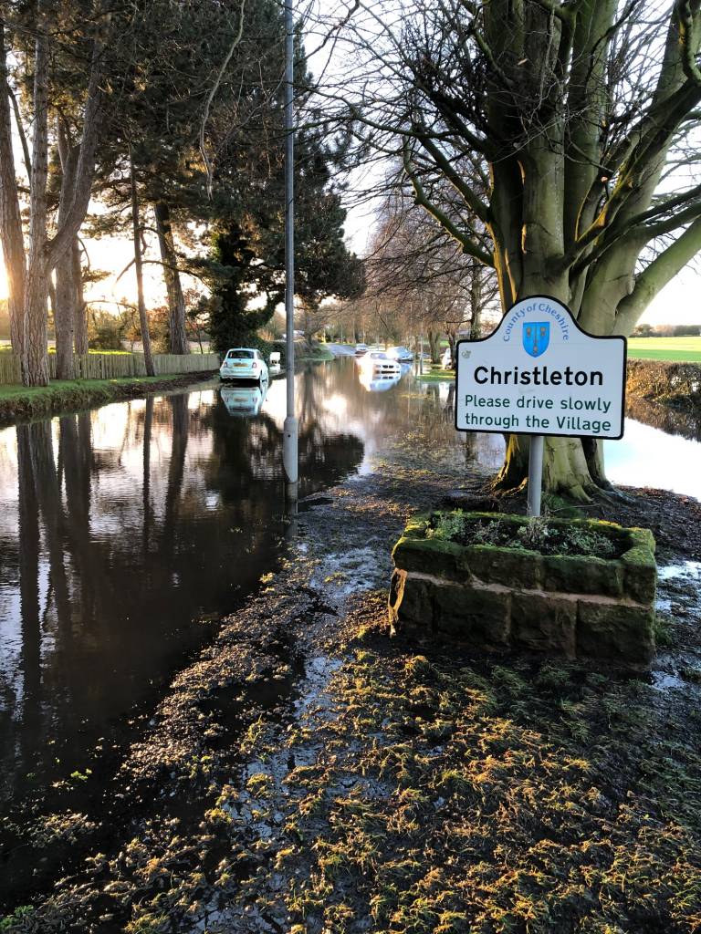
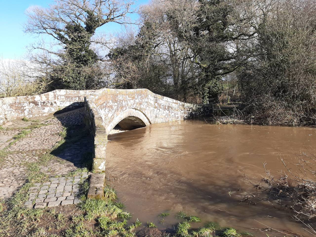
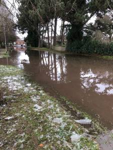
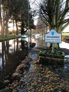
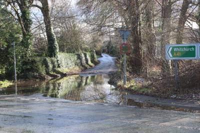
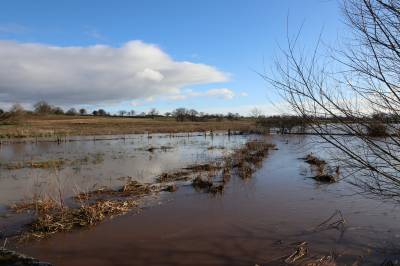
This flooding still happens today, but not as often as it used to, as the council have put in a water pumping station in Sandrock Road. There have been occasions however when the only way through the flood was to be diverted through the High School Car park. You can see the illustration of one of these occasions in the pictures. It is clear to any motorist that flooding on village roads has become a nightmare in the past five years. The Village Road/ Quarry Lane junction, Birch Heath Lane in two places, Plough Lane, Rowton Lane and Littleton Lane all flood regularly, and a couple of years ago the view of the River Gowy towards Hockenhull Platts from Stamford Bridge was really spectacular as can be seen.
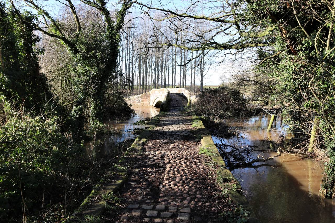
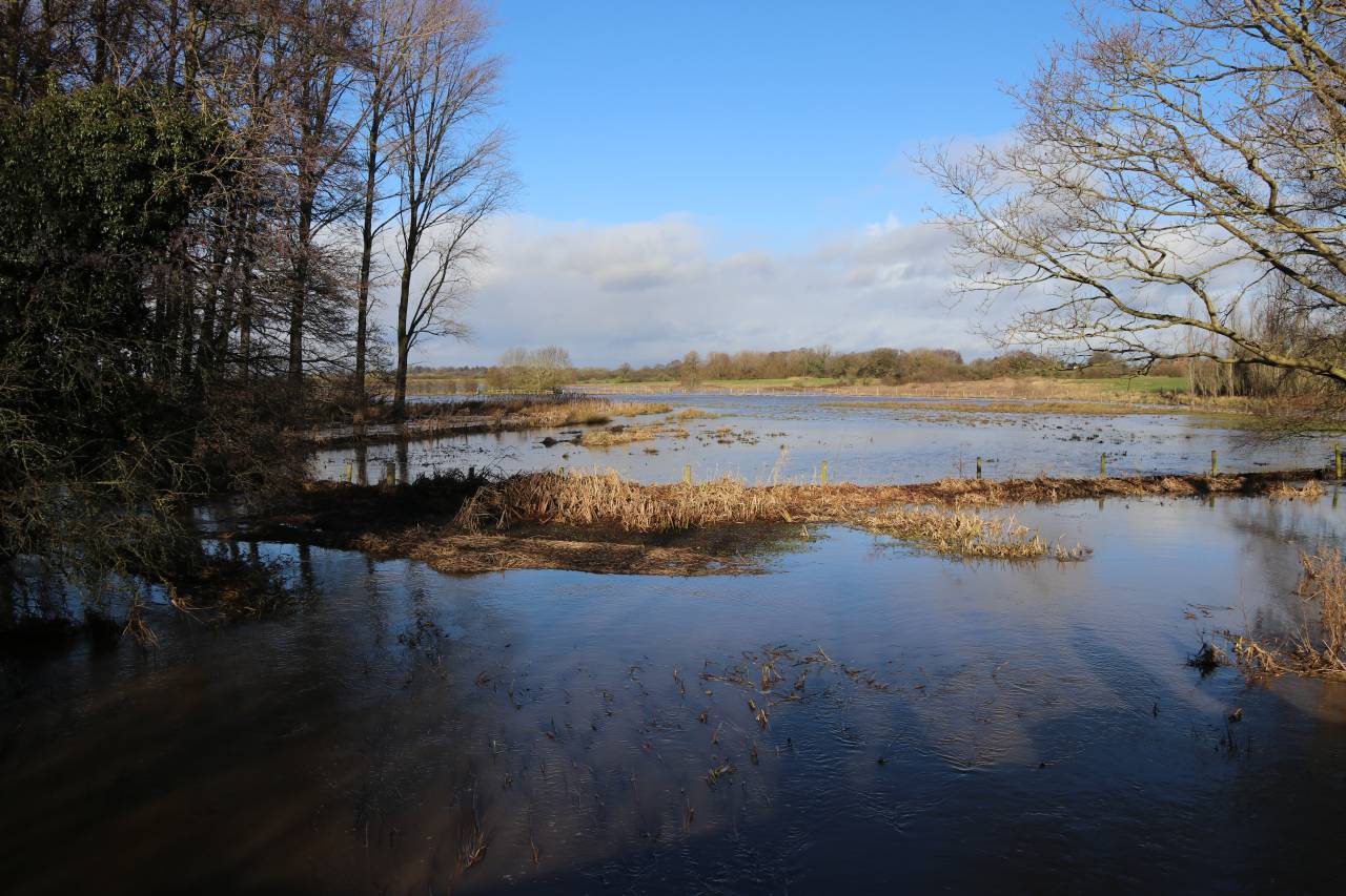
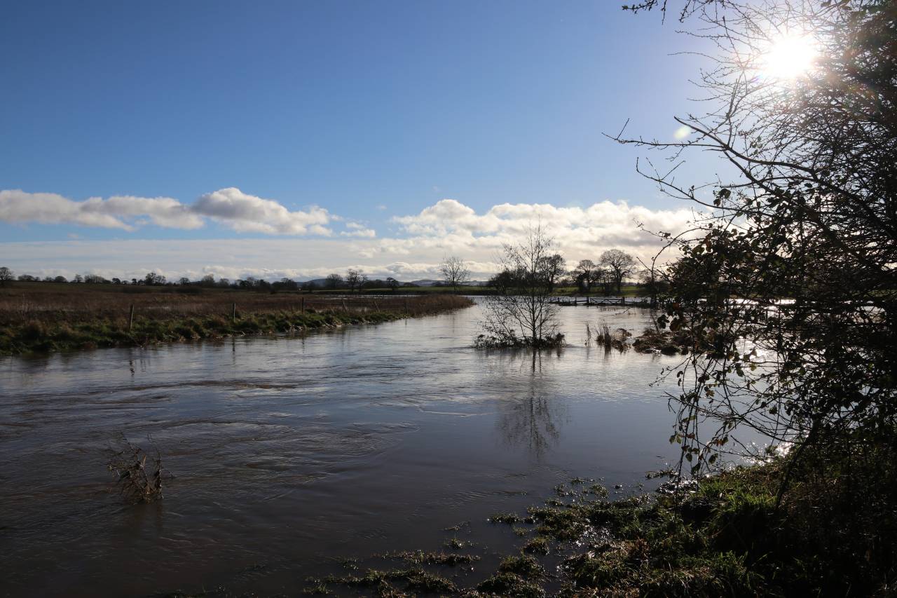
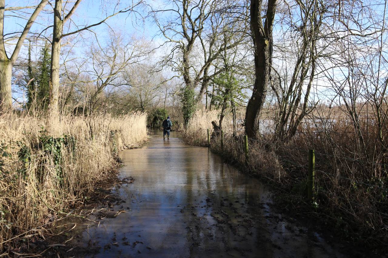
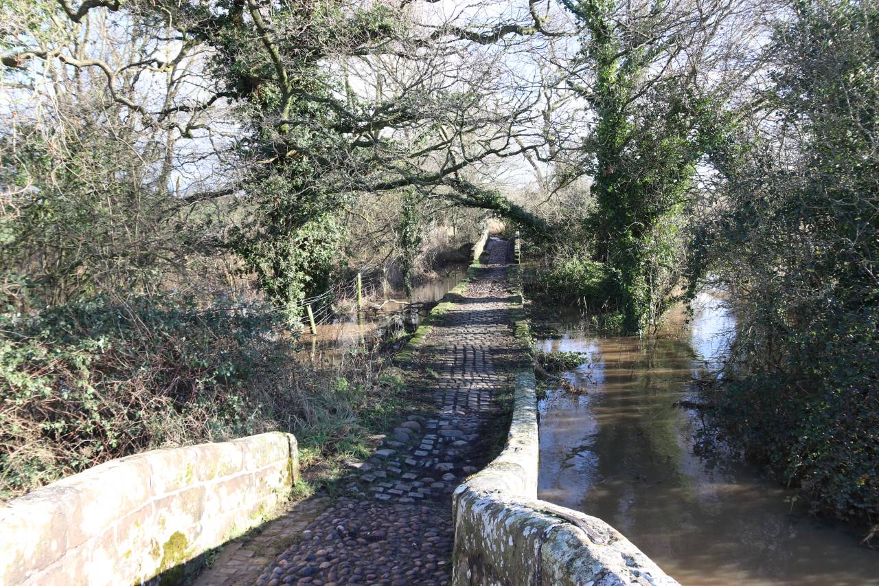
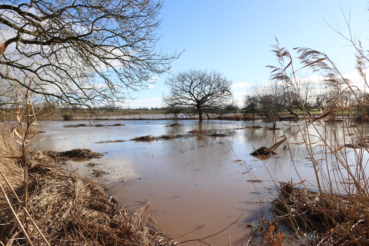
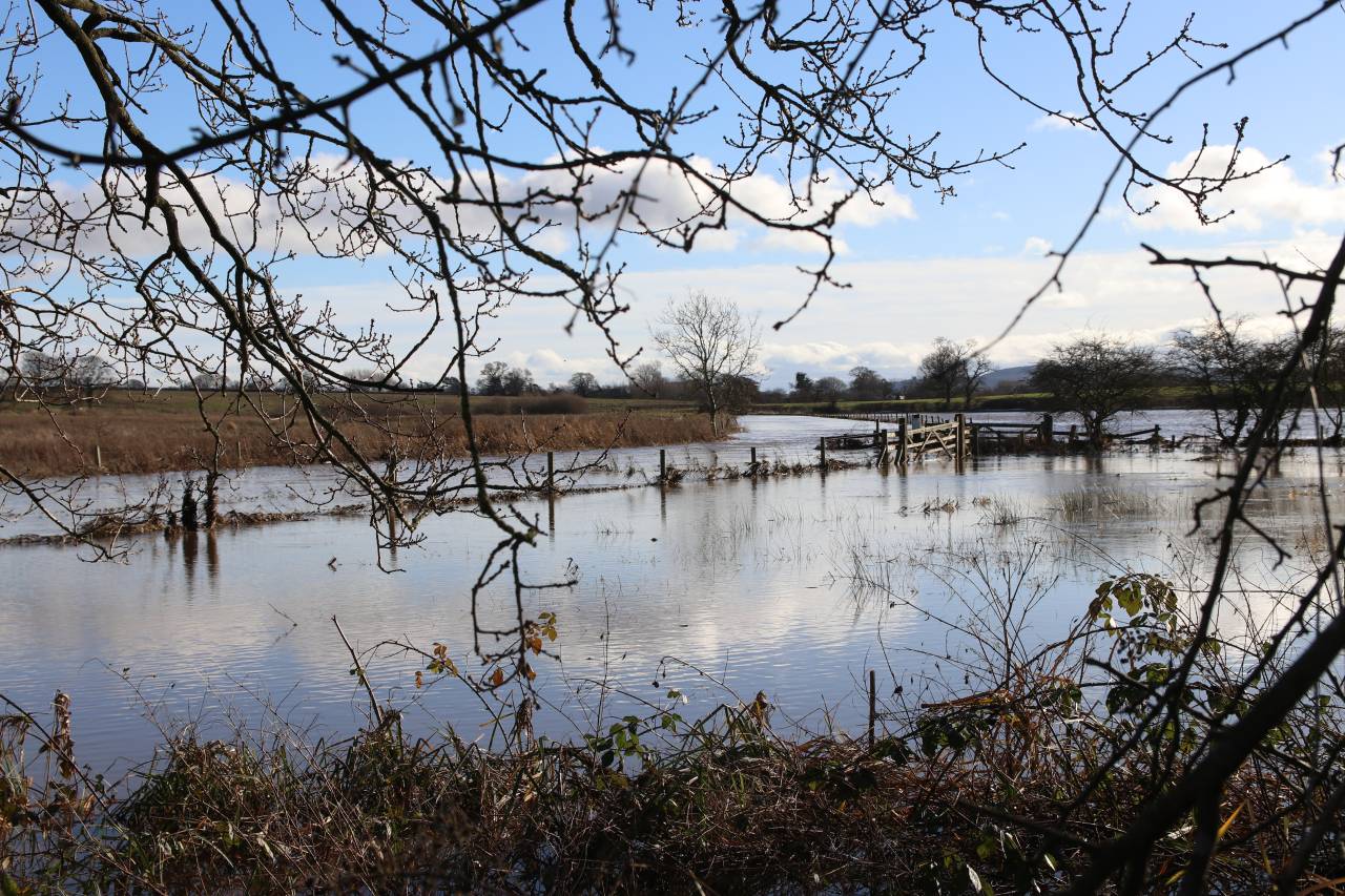
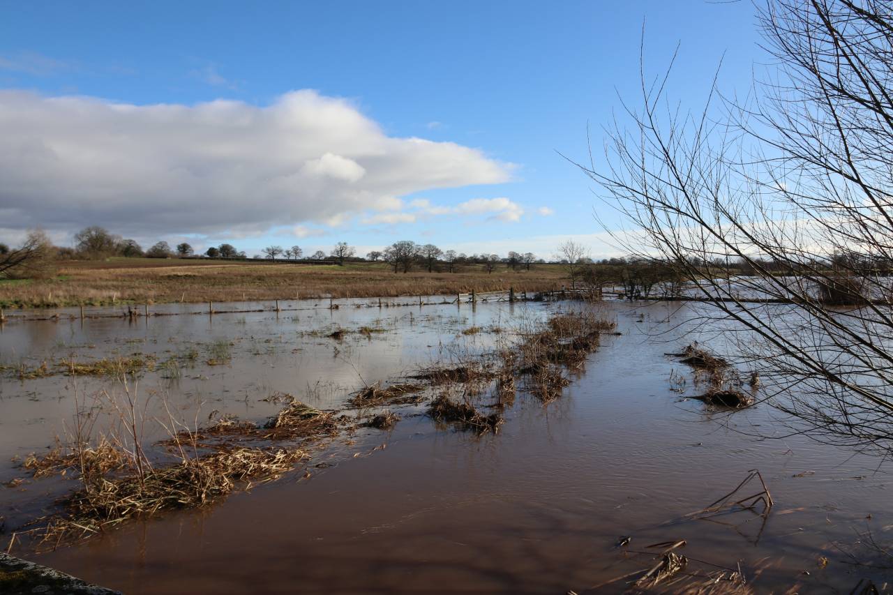
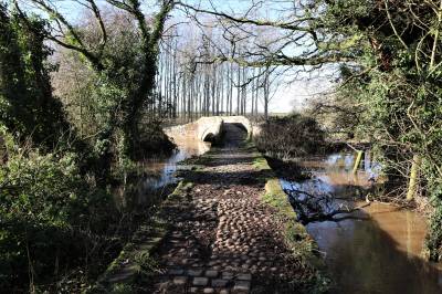
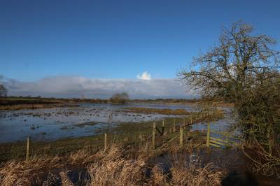
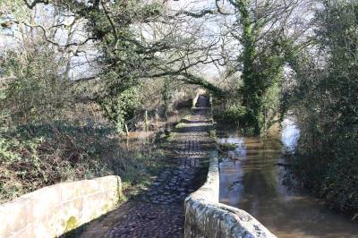
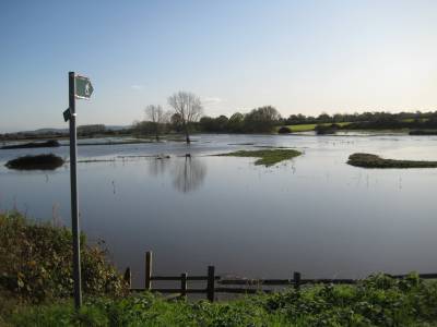
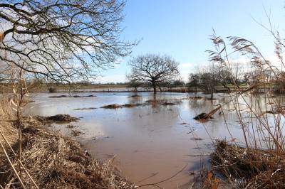
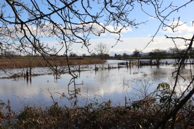
I have been recording wildlife at Hockenhull Platts for 48 years, and the last three years has been noticeably wetter than I’ve ever seen. The picture of the Gowy at Stamford Bridge is replicated at Hockenhull, where on five occasions in 2020 water was flowing under all three bridges, and the meadows flooded so that no one could enter the reserve. On January 21st 2021, after successive days of heavy rainfall, the Gowy completely overtopped its banks, and the surrounding land flooded to a greater depth than anyone locally can remember. As I am very familiar with the terrain, I made the decision to wade through the shallower floodwater on the causeway to the bridges to photograph the area. You can see the results in the images below. It was just spectacular, and there was no way I could even think of going onto the reserve area, just sticking to the bridges themselves and the causeways on both sides of the three bridges. The vegetation was rolled over by the force of the water, and the pond, meadows and the big lake were all at the same level. All the sheep had moved to higher ground and most of the ducks, grebes and geese had flown off to nearby farm fields. There was however the sight of 500+ lapwings flying over the lake, where only the top of the limestone mound on the island was visible, and the landing stage had completely disappeared. I hope you enjoy seeing this piece of our own history in the making. Thanks to Tony Watkins for his picture of the floods in Littleton Lane to compliment my own pictures of these historic occasions.
-

Roman Bridges - The Middle Bridge
-
-

-
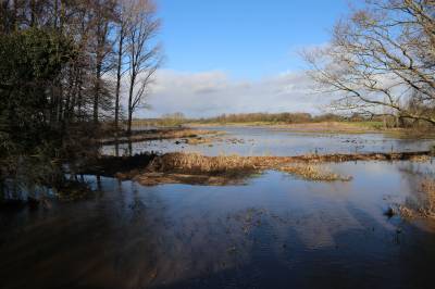
Flooded Pond and big Meadow at Hockenhull
-
More flooding in Littelton Lane
-

Flooding Gowy & Lake at Hockenhull
-
-

Flooded Gowy
-
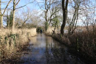
Flooded Lane at Hockenhull Platts
-
Flooding at Hockenhull.JPG
-
Flooding at Stamford Bridge 2019
-
Flooding in Littleton Lane
-
Flooding in Rowton Lane
-
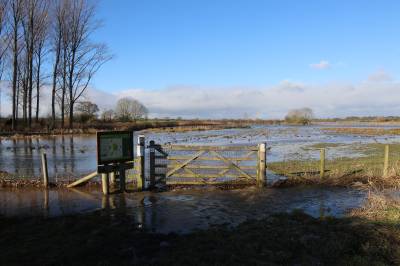
Flooded Reserve at Hockenhull.JPG
-
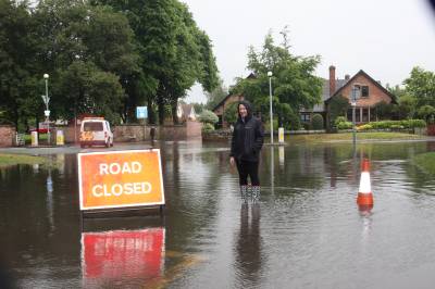
Flooding in Village Road
-

Flooding in Birch Heath Lane
-
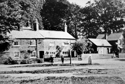
Christleton Village - Historic Photo
-
Flooded water Meadow
-
Flooded Gowy
-
Flooded meadow and river Gowy
-

Flooding in Plough Lane